To understand what it does, you could try these queries (using country polygon data from the Google Earth community):
-- Tasmania from kmzDECLARE @a GEOMETRY
SET @a = geometry::STGeomFromText('POLYGON((146.5861 41.18666, 147.9718 40.74479, 148.2733 40.90111, 148.3638 42.22243, 148.1953 41.94545, 148.0791 42.11722, 147.8429 42.87292, 147.9997 42.90708, 147.9955 43.22759, 147.7897 43.24695, 147.6316 43.06555, 147.7065 42.93833, 147.8994 43.02687, 147.8258 42.93195, 147.5575 42.83056, 147.4271 43.04174, 147.3175 42.84666, 147.2475 43.26917, 146.9913 43.11243, 147.0953 43.28872, 146.8336 43.64806, 146.0383 43.49805, 145.9327 43.37632, 146.2345 43.32514, 145.8369 43.29723, 145.4597 42.90444, 145.2052 42.25695, 145.4694 42.52306, 145.552 42.35111, 144.8586 41.54445, 144.6372 41.03194, 144.7014 40.75917000000001, 146.5861 41.18666))',0)
SELECT @a.STNumPoints() AS [PointsInRawPolygon]
 , @a.Reduce(0.2).STNumPoints() AS [PointsReduce1]
 , @a.Reduce(1).STNumPoints() AS [PointsReduce5]

But it would be even better if we could visualize the effects that
Reduce() has on the polygon data... introducing Geoquery AnalyzerPolygon data without
Reduce()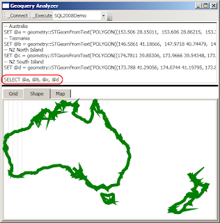
Polygon data with moderate
Reduce() tolerance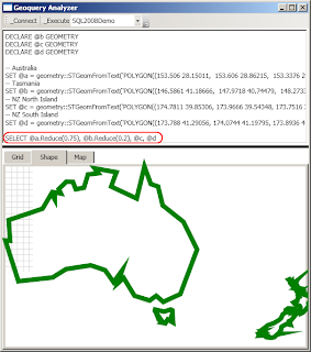
Polygon data with agressive
Reduce() tolerance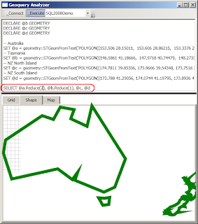
Polygon data with overly agressive
Reduce() tolerance!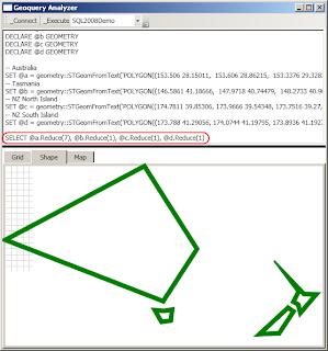
And of course, if you raise the
tolerance too high, System.AgumentException: 24127: Using Reduce with the specified tolerance will yield an instance that is not valid. Using a smaller tolerance may achieve a valid result.A few additional examples - some countries missing purely because the KML import had some errors...
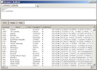
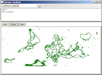
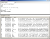
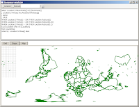
NOTE 1: Geoquery Analyzer is currently in PRE alpha development status (ie. it's pretty dodgy). If/when the code gets to a fairly stable/usable point, it'll be uploaded here.
NOTE 2: if you looked really closely at the coordinates, you'll see I've changed the latitude values to be positive... the reason is NOTE 1.
NOTE 3: on the world maps, the 0,0 point is top/left which makes it appear upsidedown
Very interesting. I'm working on something a lot similar using WPF: http://showcase.sharpgis.net/Sqlspatialquery.png
ReplyDelete