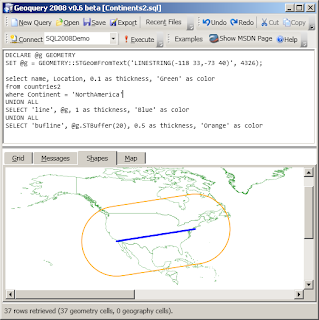
Unfortunately, this made it look rather incomplete; simply drawing a straight line over a projected map...

...isn't quite right
There are quite a few references for how to calculate the 'correct line' - I liked Ed Williams Aviation Formulary - and finally got around to giving it a try.
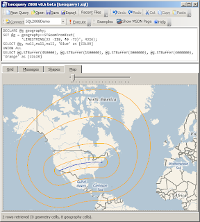
Here is how the query (and result) should look; with a couple of extra STBuffers thrown in...
DECLARE @g geography;
-- LAX 33°57 -118°24
-- JFK 40°38 -73°47
SET @g = geography::STGeomFromText(
         'LINESTRING(33 -118, 40 -73)', 4326);
SELECT @g, null,null,null, 'Blue' as [COLOR]
UNION ALL
SELECT @g.STBuffer(450000), @g.STBuffer(1500000), @g.STBuffer(3000000), @g.STBuffer(4000000), 'Orange' as [COLOR]
The interesting thing about this canvas is the 'straight line' was the only element that I needed to programmatically 'project' -- Katmai's spatial support in the GEOGRAPHY::STBuffer() result is already a POLYGON whose points can be applied directly to the map-projection (ie. it isn't just described as two semicircular shapes joined by two parallel straight lines).
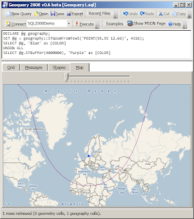
Geoquery can also correctly show buffers on points [aren't] circular on a projected map; the query from that link is reproduced below
DECLARE @g geography;
-- Copenhagen 55°37 12°39
SET @g = geography::STGeomFromText('POINT(55.55 12.66)', 4326);
SELECT @g, 'Blue' as [COLOR]
UNION ALL
SELECT @g.STBuffer(4000000), 'Purple' as [COLOR]
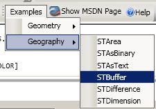
NOTE: Geoquery 2008 0.7 (which contains the enhancements described above) is NOT YET AVAILABLE for download. When it is available, it will also include the complete set of GEOGRAPHY Examples in addition to the GEOMETRY ones already available.

Hi Craig,
ReplyDeleteThe last version of Geoquery looks really cool ! When do you plan to release it? I am wainting for it !
Regards,
Patrick
Geoquery 2008 v0.7 beta is available for download now -- remember it's still very much a beta though!
ReplyDelete